Somewhere in here my brother Larry heard of my plans. He had joined me in the Sierra the previous year and thoroughly enjoyed himself; his only regret was that his wife Julie had been unable to attend (a problem corrected in 2000). With the Wind Rivers high on his wish list, he signed on after persuading her to join us. Their plans mutated a bit before finally settling down, but we all came up with a workable trip that kept us walking together until early on day four, when they would take a fast route to the car. We would start at Big Sandy trailhead and make a counter-clockwise loop through the Cirque of the Towers and over the Lizard Head trail to Valentine Lake. At that point Larry and Julie would cross Washakie Pass and return to Big Sandy (following my '79 route), while Scott, Wally and I crossed Hailey Pass and struck west to another car at the Scab Creek trailhead. This trip let my brother out a day earlier so he could see other sights on his vacation while showing me some country to the west that I had missed before. My thoroughly optimistic plans ended the first day up a side-valley toward Deep Lake and Temple Pass; first days seldom have much extra energy but that didn't stop me from dreaming...
|
|
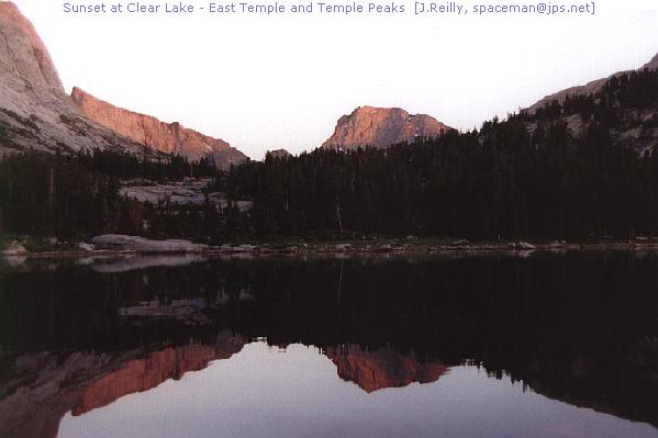
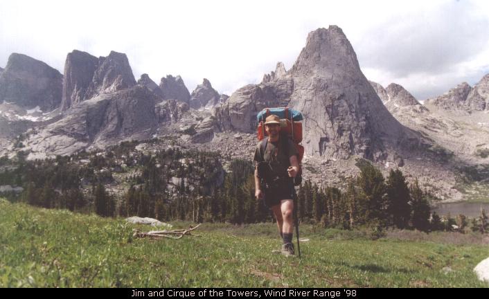
Day OneWe all met at the Scab Creek camp on Sunday night, August 10. Scott had driven separately, Wally and I took my truck and Larry and Julie also drove. We found no usable water at the camp but had brought enough to stay comfortable before turning in amid flashes of lightning in the mountains. The next morning we left my truck at the trailhead, then turned south and worked our way to Big Sandy, a huge trailhead crowded with cars. We didn't start hiking until 11AM but moved steadily up-valley with few human encounters despite all the cars. We finally reached Big Sandy Lake but I persuaded everyone to move south to Clear Lake so we could see some sights new to me. We were exhausted by the extra uphill climb but found a decent camp at the far end of the lake. The view was only slightly better than at Big Sandy and I was too tired to explore, so this detour was not turning out as I had hoped. The lake and the granite spike of Haystack Mountain was exquisite, however, and we had a good night's rest.
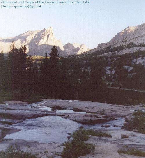
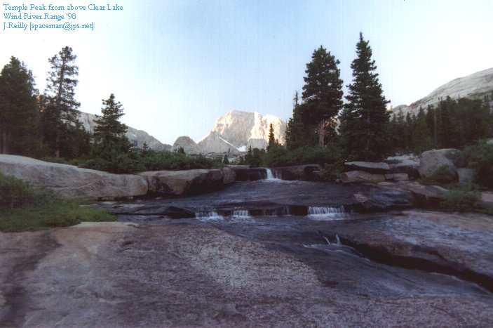
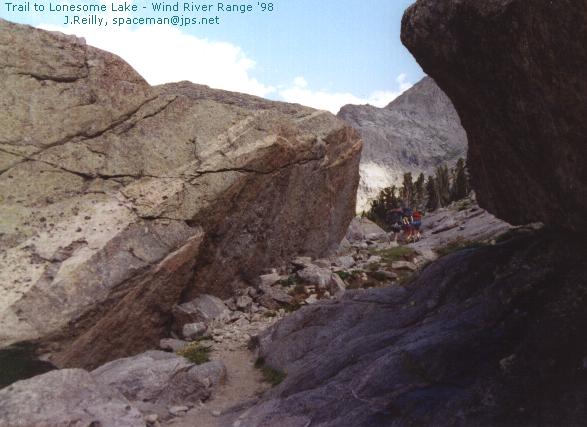
Day TwoThe next morning I was up at dawn. Thinking I had heard others buzzing about, I walked toward the inlet stream of the lake, thinking they were exploring before breakfast. No one else did but I'm glad I took the walk! I hopped up the stream over smooth slabs of granite, enjoying the view north over the creek toward the towers we would visit later in the day. At the top I found a large level area below the next lake, with at least four camps set up in between. Rather than disturb their rest I took some photos and returned to camp. Larry's stove detonated quietly during breakfast, prompting Julie to set a new long-jump record while holding a pan. After that excitement we packed up,returned to Big Sandy Lake and began the tedious trip to Jackass and/or Big Sandy Pass. [Actually, passes: the trail crests three different times but only once on the Continental Divide.] We were buzzed by a search helicopter near the top and dripped on by unfriendly clouds at the actual pass; even at this high point, mosquitoes hovered about like - well, like helicopters.It was quite interesting to see what had or hadn't changed in nineteen years. I had not recognized the huge Big Sandy trailhead, yet here was the sign at the Divide that still proclaimed our entrance into the Popo Agie Primitie Area. Since this had become a Wilderness area in the mid-80s, this was clearly the same sign I had seen in '79. One big change was the restricted camping around Lonesome Lake, now visible to the north; as we descended through this beautiful country we speculated on where to make camp. After refilling our water bottles at buggy Lonesome Lake and again taking large quantities of photos (though the 24mm lens was a great improvement!), we headed downstream toward Lizard Head Meadows. Midway between the lake and Lizard Head trail junction, we found a large and pretty campsite near the upper end of the meadows. After waiting out a brief shower we set up, relaxed, dipped in a nearby lake and ate heartily. Some of us stayed up late to watch for the Perseid meteors, but once again they failed to perform for me while in a spendidly dark wilderness.
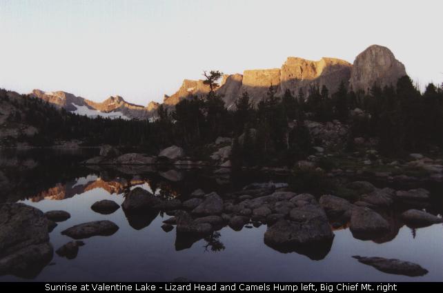
Day ThreeThis day would be above timberline for quite a while on the Lizard Head trail, so I was glad to see no clouds at sunrise. Two hours later I watched in dismay as large cumulus reached skyward while we climbed toward the highest elevation of the hike. When we reached the 'stick' (several times we reached significant places in the Wind Rivers where signposts without signs implied that we were somewhere significant!) at 11900 feet, lightning was flashing several miles south of us and swiftly heading our way. We sped along the high tundra, losing only 300 feet in two-plus miles, while raindrops, snow pellets and some hail bounced off our covered packs and heads. We then shifted into a lower gear to cross 11800-foot Cathedral Pass with thunder growing ever louder behind us. We chose not to watch the storm's progress, dashing over the pass and nearing the Bears Ears trail just as the clouds opened up with chilly rain, wind and more snow pellets for entertainment. I broke down and got out the rain pants to add to the parka, but by now all of us were cold, wet and exhausted - and still no trees in sight! We finally reached Valentine Lake late in the afternoon, only to find the easy campsites were closed for recovery. We finally found an overused but acceptable site and went on autopilot - set up tents, clean up a bit, eat some food. It was nearly dark before we began to pull out of our trances. The one day that good weather was really important had gone bad, and we felt the effects keenly; despite the storm, the views from the Lizard Head Trail were as amazing as they had been in 1979. It's a beautiful way to make a loop, and it's odd that with three different hiking books in hand none of them give this trail more than two sentences as a 'by the way' hiking option. That's not a complaint - it's a desolate trail and I like it that way!
|
|---|---|
|
|
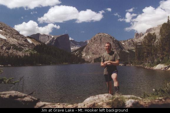
Day FourOur expedition was about to split in two - as planned. My brother's stove had failed again, so he and Julie were contemplating life without hot water. Instead we arranged a trade: Scott's stove in exchange for extra white gas so my stove could cook for three. That settled, we crossed the South Fork of the Little Wind River and took our separate paths. They crossed Washakie Pass and reached Marms Lake, then reached the cars Friday. Larry was nice enough to drive Scott's truck out to Pinedale with Julie driving their car, which simplified our work on day six a great deal. In the meantime, day four took Scott, Wally and I north to Grave Lake, a huge body of water surrounded with impressive peaks. None was more impressive than Mt. Hooker, an amazingly distinctive peak with a sheer 1500-foot northeast wall, a nearly flat top, and plenty of personality. I had heard of it and even seen photographs, but it's still amazing to see in person! After two of us slipped and immersed our feet into Grave Creek, our pace slowed and it became clear that we would not be crossing Hailey Pass that day. We found a pretty but very buggy campsite near Baptiste Creek and attempted to relax. The scenery was spectacular, and Scott proclaimed it his ideal kind of campsite (while swatting at the bugs). I put my tent on a flat slab of granite above the bugs, proclaiming it the ultimate no-impact camp. I found out otherwise at midnight, when my lower back locked up and forced me to pull the tent down to the nearest flat area where I reluctantly performed maximum-impact camping on a flowery meadow. Both my back and my eco-sensibilities hurt the next morning.
|
|
|
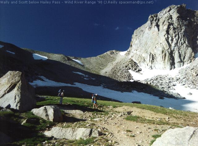
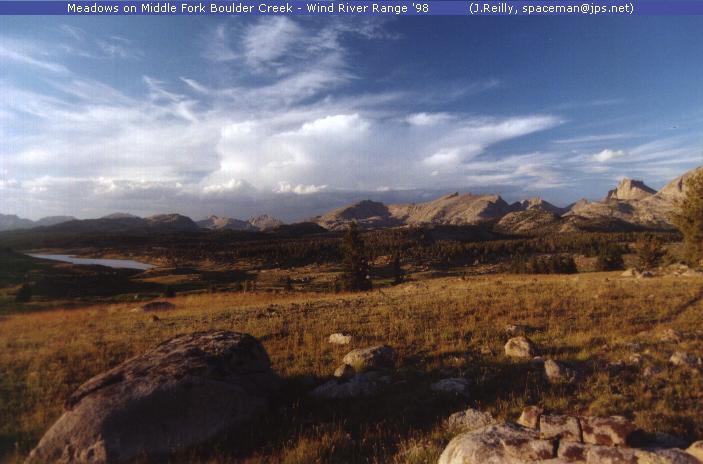
Day FiveRecharged with an Ibuprofen breakfast, I slipped into my pack (with help) and we headed for Hailey Pass. The pass was reached early in the day with little trouble, and while views were limited by nearby peaks it was still a lovely spot. We descended past the Twin Lakes and returned to timberline, passing Maes and Skull Lakes. A couple at Skull Lake had passed what we presumed were my relatives the day before at Washakie Pass; they were reportedly puffing hard but crossed the snow-crested pass without difficulty. We crossed the outlet from Shadow Lake but failed to find a right turn -- so we cut cross-country until we found a path near the Highline Trail. We stopped for a big lunch, knowing we still had several miles of work to reach Cross Lake and make the last day more manageable. We dropped down and crossed the East Fork River in its beautiful meadowed valley, then ground relentlessly uphill to a last look from above timberline, with views of Temple Peak (day one), the backside of the Cirque of the Towers and a great view of Washakie Pass and peak. We were exhausted from the climb but staggered forward a few more miles over the huge meadows of the Middle Fork of Boulder Creek (no trail to speak of, but large cairns) to a spot just past Cross Lake. We estimated this to be a 14-mile day, leaving about ten more to the car.
Day SixWell, it felt more like twelve, but we made it out by 3:30 on day six. The miles were long but pretty level, and the lack of scenery in the trees kept us moving. We started early and ground up the miles until Little Divide Lake, where a three-way intersection had a curious extra path. We took the wrong one, and it disappeared ten minutes later. Confident we knew where the trail was, we again went cross-country to intersect the Scab Creek trail. At a point of indecision we heard voices on the trail, which brought us back on track with only a minor time loss. My left ankle was unhappy with the pace (as it was in 1996) and occasionally a stinging pain would slow me down. Scott relieved me of a few pounds of camera weight while Wally raced for the trailhead and its high amenities (i.e. restroom). I made better time than they expected, reaching the car within fifteen minutes of Scott. Another thunderstorm greeted us at the trail's end, but it was too late to dampen anything but the windshield. Scott and Wally tag-teamed home from Pinedale while I soloed by a southern route through Evanston and Ogden. It was a Great Trip!!
|